Monday, July 31, 2017

California or Bust!

Closing up an enjoyable break from the road here in Grand Junction, with deepest gratitude to my host and sister Laurie; her able sidekick Negrita also made me feel welcome here for my extended stay.

Laurie invited me to an easy (5 mile) daytime (about 95 degrees F) walk (scramble over "unimproved" trail) to visit Independence Monument.  We managed to get within photo range of the stone pillar's base before turning back in search of a Dairy Queen.


July 4th Climbers 


July 31 Topper


Tomorrow, I plan to stop at a forest camp near Austin, Nevada.  Wednesday, my trip planner has set up a slow ramble through the mountains near Lake Tahoe before rolling toward Castro Valley to visit with my grandson and his parents for a few days.

Wednesday, July 26, 2017

Storm King

 A day hike today up a steep trail brought Laurie and me to the memorial overlook for the firefighters who died fighting the South Canyon Fire at Storm King in 1994.


More frequent and less destructive than volcanic eruptions, perhaps, but forest wildfires are terrifying natural forces in their own right.

  Storm King
A wind change sent fire rolling up the mountains here at six to nine feet a second. Two of the firefighters were trapped below the ridge shown below, and twelve were caught in a firestorm that swept up the valley shown on the right.

They are remembered at the memorial trail here, still tended in their memory with fresh flags, ribbons, and flowers 23 years later.

The trail itself leads to an observation site that looks over the valley; the firefighters' trails lead onward, but they were too steep and rough for us to follow.


There are still blackened stumps, but the Gambel oak undergrowth that spread the fire has regrown.

Time passes. Some day these hills may submerge, and the tree stumps become fossils that will tell their story to future archaeologists. Will the records we have made survive as well, to tell them that there were heroes here, people who died serving their country?


Coins in a stump on the trail


Farther down the intensity scale and the geologic timeline, there is a coal seam nearby that has been slowly burning out the insides of the mountain range since 1899. How many added deaths has the pollution from these fires triggered by human acts around the world caused?

We should remember all of these as well.

As Laurie and I climbed, we exchanged thoughts on the irritation of having to push our bodies to scramble around the way we did a few decades ago, stopping instead to recover our breath and let younger spirits fly past.

Well, not fly, perhaps. The trail was a steep climb, no easy walk in the woods, and it felt good to get back to the car knowing that we still can do it. It just takes us a little more time and determination.

Saturday, July 22, 2017

More Craters of the Moon photos

Lava field

Campground rock piles

North Crater center

North Crater overlook. See the back rim near the outcrop behind the center spires? It was bigger.

Trailside outcrop
A lone pine


Fast forward

All night ride last night, bridging the distance from western Washington to eastern Idaho and catching up on schedule. Three unreserved options had no room at the inn for me or for other tent-focused travelers.

My favorite one? An RV park at Historic Echo, Oregon. Lots of signs to make sure tourists know that the town is historic, not just run down. The Oregon state website may advertise RV and tent spaces, a children's playground, and a park, but the reality is a row of four RVs backed off a side street, a grass strip between them and the next residential property, a small community skateboard park, and a small public toilet building -- which was locked.

After a quarter hour of walking around, puzzling over the (also) locked building claiming to be a museum of Oregon Trail artifacts and no sign of the hosts, an exhausted motorbiking couple from Montreal and I decided to move on into the night.

The Lava Field campground at Craters of the Moon National Park is exactly as advertised, sites tucked between piles of spongy basalt ejecta and scrub desert pines. Best site choice? Shade, preferably over a flat space. Any Arizonan knows that.


Interesting display at the visitor center -- the geologic history of Craters of the Moon is linked to the Snake River "smile" of mountain-free and vineyard-blessed terrain that bridges the state and predicts the future of Yellowstone National Park! Discoveries of multiple large calderas in this region of the Pacific tectonic plate have been associated with a focused hot spot in the Earth's mantle.

As the plate slips westward, the section under pressure from the hot spot shifts east.

The hot spot prompts formation of lava domes, followed by sudden explosive collapse into large calderas that fill with basalt ejecta like the piece I am sitting on as I write this post. The earliest identified one occurred 18 million years ago.


So big, it doesn't look like a crater without a wider view

Yes, the hot spot is under Yellowstone now, and is expected to have another identity crisis some day in the next hundred thousand years. A few million years afterward, it may look much like these views of the North Crater.


Tomorrow, on toward Grand Junction, Colorado. Regret late posts -- time and useful Internet service remain a problem.

Thursday, July 20, 2017

More Ape Cave photos

The lava tube trail's name comes from the Mount Saint Helens Apes, a Boy Scout troop that explored and cleared out the current trail while searching for the Sasquatch. See http://www.bigfootencounters.com/articles/apecave.htm for more information.

Here's a link to more photos taken by a team with better equipment and photographic skills.

https://www.oregonhikers.org/forum/viewtopic.php?f=8&t=23871


My entrance photos


Some doubts about this


Inside


The mist -- invisible to my eyes

I could feel it, though.


MSH


Ginny prepared an excellent breakfast for my departure -- unmatched scrambled eggs! George and Small slipped around plotting ways to get up on the table without being noticed.

I was also encouraged to make a sandwich to take along and did so with Blue's careful oversight. Filled once again and inadequately expressing admiration, respect, and gratefulness to my host, I took my leave.

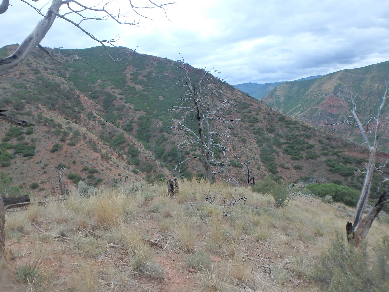
East over the Tacoma Narrows bridge, always recalling the classic film clip of the previous bridge's collapse over a half century ago, and down Interstate 5. Ginny suggested a number of must-see items in the vicinity of Mount Saint Helens, which turned out to be inconveniently located with the remains of a former stratovolcano in between them .... I chose to go for the alpine campground and forest road on the east side, and leave the Ape Cave for another day.

The GPS guided me off the interstate onto narrowing roads that wandered through cloud-obscured peaks. Mount Rainier was up there somewhere, allegedly. I stopped to fuel the Ion and eat the sandwich at Randle before heading up into the forest.


Weather, marginal; view, less so. Likely tenting conditions, wet. Decision -- scratch camping in the clouds, return downhill to the visitor center, half way around the MSH, ask about Ape Cave.

Two more hours of up, down, and around, following the gray strip of road between the tall pines. An impulse detour -- could I get a decent photo of the summit from the Climbers Bivouac? Several uphill miles of dirt road later, I did.

aa
Mount St Helens crater south rim, up close and personal

Down off the slopes and back up to the Visitor Center. A friendly ranger on duty encouraged me to visit Ape Cave and then take advantage of "dispersed camping" rules in effect for the National Forest here.

Okay. Off to go spelunking on the longest continuous lava tube in the continental US (Wikipedia) created by another MSH eruption millenia ago. Down to the valley, a few exits worth of Interstate 5, and a long rolling drive up past farms and the trees ....

At 2:40 pm, the cave entrance. It was discovered in 1951 by a logger who avoided driving a bulldozer into a collapsed section. The trail down the 2.5 mile long tube runs 3/4 miles downhill from the entrance for rational visitors -- but the one way distance uphill would be almost the same as the downhill out and back, right? The ranger mentioned something about boulder crawls and lava falls, but did not seem too concerned; I was wearing hiking boots, carrying water and wearing a headlamp. No problem.

The first half mile was strange, beautiful, not at all claustrophobic. The glassy black walls of fused rock formed a high arch above the frozen flat floor of lava that had poured down the tube. Climbing the first pile of boulders was easy, obvious signs of a well used and maintained trail. The second, a little less so, and the third actually took some care to choose my route over the rocks. Not so different than the rockhopping scrambles that my sister and I had enjoyed along Sonoita Creek long ago, with the advantage of having no sun burning down on me.


Then the first lava fall, where the molten rock had frozen as it poured over a ledge about six feet high and smooth except for one foothold that had been hacked into the stone. There was a family of four trying to climb, so I boosted them up, and they pulled me. Standard "O" course approach. The parents thanked me and declined my offer to stay with them the rest of the way, so I went on.


Another two boulder crawls, over open rock rubble. I wondered how many people with sprained ankles have to be evacuated from here? Then, another lava fall to crawl up after spotting three heavy set sisters trying to work their way down. I waited for the family, but they waved off help. Onward, then. feeling the pressure of the lowering ceiling. .


Many boulder crawls followed, some with misleading paths that had me backing down to try a different approach, some that required going through on hands and knees. Three things to bring next time I try something like this: spare batteries, a hiking partner to go for help if I sprain an ankle, and gloves.


Photos -- not much use, really. The flash did reveal mist blowing downhill inside the tunnel, not visible to my eyes.


Up, up, up, boulder crawls getting steeper. How would the family manage, I wondered? The parents seemed confident, the children cheery.


The first skylight! A group of teen guys, clearly gripped with the same almost-panic that I was fighting, was trying to climb out the steep and lichen-covered walls. I excused myself past, reminding them that the ranger had said that the second one was set up as the exit.


On, on, on. The black glass walls closed in, sending me down on hands and knees to crawl under low points. I never cracked my head on the roof, but brushed it two or three times. I could hear the guys who had given up on the first skylight following me.


Finally, the second skylight, with a stepladder. "Found it!" I called back down the tube. Up into the forest, distracting a crowd of students from their teacher's efforts trying to stir interest in his students, Socratic style. They weren't buying it.


Downhill, then, as the shadows deepened over recognizable vents from the tunnel below, chatting with others who had gone through ahead of me. How amazing and strange, I said, something I did not know I had to do before I die, and now I've already done it!


Back at the car, I tried to find the energy to set up a waterless bivouac for the night Desires for wifi to finish planning for tomorrow's travels and for a celebratory dinner won out.


From a sign at the Visitor Center, along a memorial walkway over wetlands created by rockslide dams during the eruption --

As we reflect upon those who died during the eruption, we must respect the unimaginable power of natural forces. Some will only remember the mountains explosive eruption, and others will only remember those who died.

May 18, 1980. Let's remember it all. 

Wednesday, July 19, 2017

Back to the US of A

Very slow wakeup this morning after yesterday's marathon drive to Port MacNeil and back, taking advantage of generous slacktime I had planned in before the 1:30 boarding start in Victoria. Double coverage, really, since the boarding began 90 minutes before the actual ferry departure, allowing for U.S. customs.

I drove down to Nanaimo, parked, strolled to the boardwalk, had a cup of "Tiger Butter" ice cream for a snack (erm, well, interesting ...), and went back to the car with plenty of time for the drive to the ferry port

except for the road construction. I did post something about the excellent road conditions? There's no such thing as a free lunch, or 100 percent uptime without maintenance shutdowns. The workers were alternating northbound and southbound traffic through one lane at a time, and our direction included a largish construction shovel inching along on treads.

The Ion was the second-to-last car to make the ferry. (Whew.)

At 4:45 pm, back in Port Angeles, with 1500 more kilometres on the odometer. Ginny had reminded me, so I stopped for dinner at Gordy's in Port Angeles -- don't miss it if you happen to visit here, best pizza west of the Five Boroughs.

Soon again, Vancouver Island

Tuesday, July 18, 2017

Vancouver Island in a day


"Serious Coffee". Hey, somebody get this chain franchised south of the 49th Parallel, and it may actually force Starbucks to start serving coffee ... serious muffins, too, I had to ask for a box.


Nanaimo's busy harbor hardly seemed interesting as a kayaking place. Given advice, I turned the Ion north at 1:50 pm for a four hour drive to Telegraph Cove and Port McNeil.  On a whim, I took the Oceanside Route to go local, get away from the four lane concrete rivers for a while ... sundown isn't until, what, 9 pm or so.

Discoveries on the back roads --

All the roads I traveled on were in excellent condition. Pretty impressive, given climate and heavy truck use by the lumber industry, eh?

In Courtney, A&W Canada is offering a 20 oz. cane sugar root beer with sweet potato fries! Could it be the same in the USA? I haven't been to one in years, but this root beer tastes like I'm ten years old again.

A sign in Parksville advertised the "Brigadoon golf course". Okay, both Scottish heritage, but does the course only appear when the PGA tour is in town? Slightly different connotation of walking through the heather, also.

Along both the Trans Canada Highway and the local roads -- small blue roadside info signs about ten cm square marking Artisan shops, with a white tag underneath for the kind of art -- pottery, quilting, metalwork, dance, and so forth. Slightly larger ones mark the B&B's ... and the wineries get much larger boards, brown and white. Flashy USA style billboards are rare outside the cities.

Cyclists coexist with 90 kph (55 mph) traffic along narrow margins. I wouldn't, but it works for them.

Hitchhikers also, mostly solo. No safe way I could see to stop and pick them up, even if I had room.

Stark and strangely shaped peaks, deep valleys ... Telegraph Cove looked much better as a kayaking venue. All closed up by the time I arrived, unfortunately.

After a Thai chili wrap at Gus's Grill, I refueled and headed back at 7:35, adding another four hours to a long and enjoyable day, wishing I had more time and marking off the things I wanted to see next time.

Seaplane takeoff Nanaimo harbor

Does anybody know what time it is?


Port MacNeil


Monday, July 17, 2017

Visiting a civilized country, no passport required until you leave

Ginny and I walked down to the state park beach with Blue before I left, resolving the world's troubles and supporting Blue's favorite exercise.


Looking out across the Hood Canal, I found myself wondering once again why I have passed through this part of the country so often without actually settling here? Not for lack of interest ... might have something to do with thoughts about the winters that leave snow packs on all the mountains.


View from Ginny and Steve's house


To Blue, all our concerns must seem to be wasted effort. The important questions are clear, and he knows the answers. When there is water, jump in it (not flowing water, an important distinction). When the water is big enough for swimming, find a stick and bring it to the Boss. When she throws it, race out to capture it, carry it back huffing and chuffing, and bite it a bit just to teach it a lesson. Then take it to the Boss, lay it down, and shake the water off your coat. That seems to amuse her for some reason.

Oh, and when the Boss calls, drop everything and come a-running! Then shake your coat off once more for good measure.

North, and then west into the Olympic peninsula. No submarines headed out today, so the drawbridge to Port Angeles was available, the trip through the deep forest was easy, and I was among the first cars to queue up for the 9:30 ferry.

Why is the ferry experience so much less irritating to me than the airline's? Same long delays boarding the flight, certainly. The obsession with invading personal space in the name of security, though, is absent, as is the focus on jamming as many bodies as possible into physical restraints.


Time 11:10 pm PDT. Odometer 217918. Victoria, British Columbia.

The GPS took me out of town and down a dark highway to the Malahat RV Resort, where I set out my tent in the shadows of unoccupied RVs and slept untl 5:30.

Why exactly did I come here? Right, Nanaimo. Kayaks. Canada, eh?

Sunday, July 16, 2017

North by Northwest

 4 am ... Bend, Oregon, after a long drive. What day was I supposed to be in Grand Junction? Cross check. July 24, right. What day is today?

Slow start, only 5 hours driving to go, plus traffic on Interstate 5. Those Californians, they just drive in circles all day. Not that we have anything against them, really.


Country Nook Restaurant. Spanish omelette with avocado on top and 1/2 inch thick wheat toast because, well, Left Coast. No WiFi, though; waitress apologized, owner closed access to customers out of security and inappropriate use concerns.

Inappropriate use? I did not ask.

Of note -- in Oregon, full service is the norm. No self service. Attendant was ready to be defensive about it, but I preempted with a declaration that it was safer than customary self service practice elsewhere. Which it is.

Northward! Passing over the Crooked River, skirting Mount Bachelor and Mount Hood. Locals and aficionados can identify all of the snowtopped peaks between here and Vancouver by shape, but I need a map. Mount Hood is reasonably easy to identify from US 26, though.


Crooked River Canyon

Mount Bachelor?
Mount Hood from the coffee house

Mount Hood from a little closer

Interstate 5 provided a less than welcome reminder of the world I left behind this summer, both while skirting Portland and again passing by Tacoma. Don't these people understand? If they can't get this under control, their fate will be the same as commuters in the Washington DC area!

Family friends Peggy and Larry were eager to hear about children and grandchildren, and to introduce me at the nunnery where they attend Mass. The priest, one of the many who speak from the Spirit rather than from the hierarchy, had good common sense advice to offer. Why do we worry so much about how others behave? We can let that all go, be free of the burden of trying to judge all those people -- and focus on getting on with our own lives. Amen.

Friday, July 14, 2017

Will the circle be unbroken?

Keith stripped down his old pack before heading over to the airport, cutting back weight to avoid airline surcharges. Want some wool socks?

Airport shuttle run, breakfast, laundry, cleanup. Northbound, then west Into Oregon again at 11:30, 217072 miles on the odometer.

Sign on a pair of weathered silos "Vale or bust!" Vale was only four miles farther down the road, so hopefully they made it.


I stopped for an early lunch at a roadside cafe deep in the range of hills south of the Malheur Forest. It was refreshing, with friendly counter service, and large helpings -- but when I pulled out, I headed the wrong way. Again.

It was the potato salad that did me in

Corrected, refueled, back on track westbound toward Bend, Oregon.

Time's long churning of the earth's surface is very visible here. The mountains with their seabed layer caps driven up by a burst of volcanic activity as recently as a million years ago, are collapsing into rivers of gravel and dirt pouring over the harder rock layers. They almost look like one of the strange buildings Gaudi created in Barcelona. 


Below, the creeks cheerily drag it all toward the sea. Will the cycle ever end? A few decades ago, almost every scientist would have confidently said yes. Now, with theories once mistaken for facts in doubt, phrases like "dark matter" and "dark energy" stand in for the "aether" that 19th century physicists spoke of and the Renaissance cartograghers' "Here there be dragons" admission of old.


Actually, we're not sure, let us know what you find if -- er, when you get back.


Another sign. "Do Not Pass Snow Plows On The Right." Good advice, even in summertime. Also, coffee may be hot.

After visiting with friends and family in the Puget Sound area, I will take Black Ball ferry into Canada for a short exploration. Then, south to Grand Junction, west to Castro Valley, east to BeATrice, Nebraska, farther east to Pine Grove, Pennsylvania, and the finish line.


I just keep rolling.